Make an Open-Source Web Map with QGIS
Introduction
2:01 - Workshop overview
Setting up the map in QGIS
3:10 - Static vs. web maps
8:46 - Exercise overview
10:10 - What's in the sample dataset
12:29 - Opening QGIS / adding data and basemaps
15:53 - Changing the project's Coordinate Reference System
17:22 - Organizing project files
18:24 - Exploring the attribute table
20:55 - Symbology (categorized)
24:55 - Symbology (two variables)
28:22 - Symbology (graduated)
Using the QGIS2Web plugin
34:03 - Overview
36:40 - Setting up the project for export
45:04 - Plugin's layers and groups tab (layer visibility, popups)
49:07 - Plugin's appearance tab (abstract, widgets, default extent)
56:06 - Plugin's layer visibility tab
56:50 - Exporting the web map files
Publishing the map in GitHub
1:00:54 - Overview
1:02:14 - Logging in to GitHub / creating a new repo
1:06:04 - Editing the ReadMe file
1:09:10 - Uploading the web map files
1:13:34 - Publishing the web map with GitHub Pages
Random hot tips
27:58 - Renaming a layer
33:08 - Making a copy of a layer
43:12 - Applying symbology from one layer to another
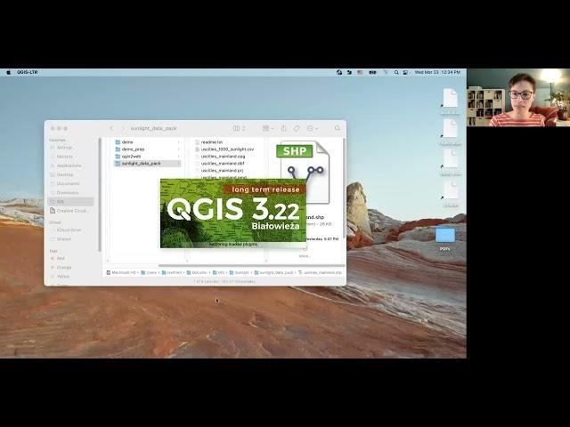
Recording from the workshop "Make an Open-Source Web Map with QGIS" by Dr. Becky Seifried, Geospatial Information Librarian, UMass Amherst Libraries.
Тэги:
#GIS #web_maps #QGIS #QGIS2WebКомментарии:

Interesting. Thank you for sharing.
Ответить
Great Becky, thanks for the knowledge shared. pls what's the best methods/apps to use in developing a GIS web based land information system (LIS)
Ответить
Thank you for your sharing.
Ответить
Thank you so very much for this. Definitely learned a few new things I have not noticed before. One question, is there any way to make the legend collapsible to hide the symbology? If the symbology that is applied has a large variation, it leads to having to scroll to turn layers on and off. Any idea on how to achieve this perhaps?
Ответить
I followed each step and finished my first successful web map with my own data that I collected. Thank you so much!
Ответить
Thanks Rebecca it is a great tutorial video :)
Ответить
Thanks Rebecca for the informative tutorial!
Ответить
Hi Rebecca thanks for the clear explanation, almost everything is working great for me, but tab "Layers and Groups" never show me the Popup Fields, only shows "Visible" and "Popups", do you have an idea what can be happening. Thanks!
Ответить
Great workshop, very clear, thank you so much Rebecca
Ответить
Could anyone answer ...Does the web map work well for layers with thousands of features.? When i preview my web map (before exporting) , the preview of my web map is very slow and sticky.
Ответить
Rebecca, thank you very much! your video is realy well done, clear and complet!
I had develop my own webmap but I have some dificulty:
- With just some datas, I can charge the update preview easily. But when I use more layers, it's difficult/impossible to download the preview and so to export... Do you know if there is a way to make it easier for the software?
- In the legend, I have some layers with a lot of informations, but they contaminate the legend. Do you know if it's possible to manage the legend and take off some informations? I saw that I can delete the color information in my source document, in "legend", but not the wrote informations.
Thanks again! Have a great day.
Thomas

Excellent workshop. Thank you
Ответить
Thank you for the video. Is it possible to make a web map with time-series data?
Ответить
How can we create/link a webbased Jason/GeoJason data from html and make it into a static QGIS map
Ответить
hi, do you have a link of a complet guide or toturials for webgis, thanks a lot for shring
Ответить
Great tutorial. But I am unable to see the column for the 'Filter' created once I have selected a feature as the Attribute Filter in the Appearance tab. I don't understand what I'm doing wrong. Could anyone help?
Ответить
One of the best workshops I've watched recently. Thank you, also on behalf of my students.
Ответить
Is there a way to communicate with
Ответить
GREAT VIDEO!
You've probably already covered this in previous videos but I'd just like to add that I found out the hard way that when you duplicate or copy a layer, it uses the same underlying data as the original layer you copied from. This means that any changes or "edits" you make to the newly copied/ duplicated layer will also be made to the original. Also, never have two maps open in separate instances of QGIS that are editing the same data set. BIG mistake. LOL..... (I can laugh now)

Great tutorial.
Ответить
What a great qgis2web tutorial. Thanks so much for all the work in putting it together and sharing it! I'm sorry about the attribute filters not picking up the layer names properly - that is a bug. And I'd love to know why popups weren't working when you initially chose OpenLayers as your export format. They should work! But again, thanks!
Ответить
Very impressive presentation.
Ответить
Hello Mam, Which programming language is used for this webmap??
And Great Video

Great video, right now I'm having a bad time trying to figure out how to add a legend for a raster for this webmap. It's actually a simple idea, my raster has 8 categories, but I can't find how to show those categories on a legend in the webmap... do you know how could I do that? Thank you!
Ответить
