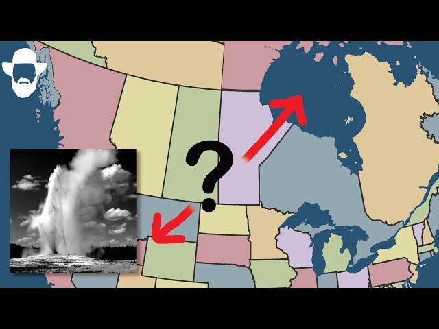
Yellowstone to Hudson Bay Connection: What Happened?
Комментарии:

Fun fact: from the headwaters of the Missouri to the Gulf of Mexico is longer than the Nile in Egypt and Ethiopia. If we'd followed naming convention and named the entire river after the longest branch, then the Missouri would be the world's longest river. Sure, the Mississippi was named before the Missouri river was fully explored and surveyed, but the fact remains that the longest river in the world is in North America, not Africa.
Ответить
Can anyone tell me what 3D topographic map software he’s using? Looks so much better than Google earth!
Ответить
Quality video. Great job!
Ответить
aliens?
Ответить
geo Engineering.
Ответить
Honestly your diagrams are exactly what makes your videos very understandable to a layman
Ответить
Thank You Myron, you craft the story and image so clearly...
Ответить
I come for the drones and stay for the whiteboard.
Ответить
I thoroughly enjoyed your video. I am wondering how you determined 70,000 years ago as the time of the change of the Missouri River's direction.
I don't think its that long ago. A minor point that makes me believe this is What about the Erosion? Seems like some things you mentioned erode much faster. But then you come up with the figure of 70,000 years ago for the part about the runoff of the glaciers. I am studying geography of the earth & the geology that you study is excellent backdrop for studying what some of us are studying. BUT the time frame does NOT match.
I'll tell the others about this channel & recommend they take a look.....but they are not going to agree with the time frame. We see the changes occurring Much more Recently. (this is our perspective on all traditional geology....not this one example of the glacial runoff & formation of rivers. So, how do you come to the conclusion that this happened 70,000 years ago??

Something about this theory of the ice sheet diverting the river sounds off to me, wouldn't the ice sheet have eroded most of the old, northward Missouri valley away? I would have thought especially towards the edges of the ice sheet, that the erosion would br substantial and would erase many features such as the old river valleys.
This leads me to believe that the change in course happened more recently.

Is it possible that Minnesota being the state of 10,000 lakes has evidence of the Mississippi once having a drastically different path as well?
Ответить
I would’ve liked to traveled along the Minnesota River Valley towards the very end of the last ice age when it was completely filled to the top of water and at spots was 5 miles wide and 250 feet deep and there was a gigantic waterfall where downtown St. Paul is at right now that according to geologists was just as large or larger than Niagara Falls is today.
Ответить
According to geological analysis, I’ve seen online the Mississippi river in the Minneapolis St. Paul area has shifted east and west quite a bit during the last Ice Age. The chain of lakes on the west side of Minneapolis used to be where the ancient Mississippi river used to be, but that valley was filled up with glacial till and the river was shifted eastward .
Ответить
Also according to bedrock analysis, the Mississippi River originally started in the middle of Nicollet County north of Mankato Minnesota then headed northeast toward Bloomington then southeast twords present day Red Wing Minnesota , Then the ice ages came and remade the entire landscape.
Ответить
My man's is standing right in graveyard of a massive flood, which is most likely the reason why the river diverted it's flow.
Ответить
I just love these videos.
Ответить
So when the ice sheet pushed the river to the south why didn't the old river bed get totally gouged up and destroyed?
Ответить
Wow & Yes!
^..^~~

What shoes do you think fit into the different categories, good heel hooking pair, good toe hooking, edging, smearing, etc.
Ответить
Fantastic! I may spend the rest of the night thinking about this. Very good work
Ответить
So cool Myron. I guess I'm getting to be a fan. I've gotten so used to Nick Z there on the Columbia over the last couple of years. He's a teacher you know. And so, here you are teaching. Wow. Just great! Thanks so much for all of this. Sure, I can see all of this, every morning with my coffee, not worthy, from New Hampshire. 👍
Ответить
Great job,,, but,,
Everyone knows there was no climate change before the Industrial Revolution.
Please continue to educate. ;-)

Lemme guess: It's isostatic rebound after the ice age?
Ответить
Best presentation of how glaciers shaped the lands they inhabited. Never thought I'd be excited to hear "let's go to the white board"😅
Ответить
This might be my new favorite video. Every part of it was so delightful.
Ответить
Wonderful story and thanks for the info 👍
Ответить
Also here for the algorithm! Any excuse to watch a great presentation on the geology that is litterally an hour from where I'm sitting. 😊
Ответить
Outstanding
Ответить
Wow! Very interesting. Great for trivia game.
Ответить
Or the us redirected the river back early settlement era of western expansion?? The bend is at (coal banks) so they piled up rock from coal lining and redirect the river😮
Ответить
Sorry to disagree with your speculation of events Myron, but I live along the Milk River in Canada, and followed it into Montana, then finally where it emptied into the Missouri. It's path to the Hudson Bay was not diverted where you thought it was. You speculated that it turned from its path to the Hudson Bay near Coal Bank, rather than heading north to Havre and the Milk River. However, the Milk River meets the Missouri farther downstream near the Fort Peck Dam. Together they turn south before meeting the Mississippi in St Lewis MI, much farther downstream. I would suggest the Missouri's diversion was North Dakota, in an area that often floods into Canada, causing devastation to the city of Winnipeg before draining into ... the Hudson Bay (where you think it ended up).
Ответить
The Colorado river used to empty into the Salton Sea, several different times, but because of land shift I.e. San Andreas Fault…..it has diverted
Ответить
I think the glaciers went farther south, possibly in a previous ice age. Richardton ND sits on the edge of where glaciers stopped. From the Assumption Abbey, you can find a view usually reserved for mountains. All the land to the north is considerably lower and flat. So much so, that you can see the curvature of the Earth.
Ответить
Our farm is north of Crosby,N D, and is a mile south of the Canadian border. I remember in the late 60’s we saw a truck in the ditch with a portable drilling rig on it just to the north of our farm and south of Long Creek which is part of the Souris drainage. We drove down to see what was going on as it was drilling. My dad talked to the guys on the rig and they told him it was part of a Government study to find the ancient bed of the Yellowstone river. We never did hear what the outcome was of that study. Incidently, the Kettle Lake you mention was a famous swimming hole as my mother told me many times they would drive there to swim in the early 30’s. It was known to be a very deep lake, so the water was cold on the hottest summer day……… This Lake would have been 30 to 40 miles to the SW of our farm.
Ответить
Oh Myron I’m so glad this” re-cycled “ on my site…I have it check marked ,so I’m delighted to be back! I spent a lot of last year in and out of hospital…so I truly watch for your work…it seems “a new river channel in my brain “—changed stations! To make sure I’m “all here” I took some tests!!—well I’m happy with 97% …pretty good return for strokes…I remembered my enjoyable times with your channel Myron…..I like your visualizing technique…Ive don’t it all my life…used it well prospecting
Ответить
Thank you for helping us make sense of the landscapes we enjoy seeing around us, to see nature through the eyes of a scientist is so exciting.
Ответить
Between you and Nick Zentner I am being well educated. Thank you
Ответить
I live on the Lower Rhine river valley in Germany and I’ve always wondered why there were so many gravel mines here. I always knew it had something to do with the river as some of the mines are directly on the banks but now I understand the exact mechanism! Thanks for the video.
Ответить
Now do Mars!
Ответить
Another interesting and informative video. Thanks!
Ответить
Climate changes...again and again!!!....wow NO PEOPLE , no corporations, na B Gates...
Ответить
I was wondering why the Missouri River did not resume its old course when the ice sheet melted?
Ответить
Very Interesting! I looked at the region myself in Google Earth and as an engineer came to the conclusion it wouldn't be hard at all for us humans to redirect the Missouri north again. An around 70m high dam a bit further downstream would create a lake which would overflow north into the old river channel.
Ответить
0: 55.
The Missouri River is really the Mississippi.
Every continent has it's major river system, and all of them have the longest river(s) named as that river.
Except the Mississippi.
If the Mississippi River system were named correctly, the Mississippi would be the world's longest, besides the most prosperous.
So everyone needs to join in with the renaming of the Missouri River to Mississippi.


