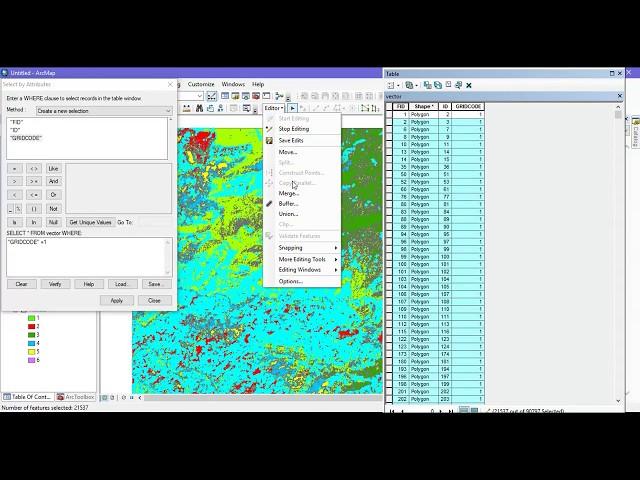
Reclassify & Convert Raster to Shapefile ( Polygon) & Calculate Area Using ArcGIS
Комментарии:

Thank you. It was useful.
Ответить
Thank you
Ответить
Hi, I hope you see this comment, when you selected gridcode 2, It selected land cover from different classes, that imply that the grid code doesnt just contain a certain class information e.g forest=2, grassland=1? I am facing this similar issue right now, the vector dont have classes as my raster
Ответить
thanks you ....
Ответить
thank you very very very much it was usefull
Ответить
Hello can you tell me how to calculate area of each class in each 1 square km grid (which i have put)
Ответить
Thanks for the wonderful video. How can I do coverage area calculation for a specific location in 50m or 100 m radius?
Ответить
Hi. Thank you for the video. Just a quick question: at the end, if the "merge" option is greyed out, can we use union instead?
Ответить
Hi,
How to get values of a raster by drawing polygon on it via shapefile?
I have calculated the NDVI of a raster file and i want to find the average value of each plot in the NDVI raster.
I drew polygons on each plot but i'm unable to extract any values. Can you help?

good
Ответить
What the data that needed to run analysis buffer tool? Help 😩 i just have tiff format data
Ответить
Thanks for your useful vlogs about ArcMap, I converted raster format to vector(.shp) format but after conversion the map is as similar as raster map, i.e. still it is a blur map like raster map, so plz help me if you know how to fix this issue. I have only raster format file.
Ответить
plz reply me if possible, tnq
Ответить
Hi terra spatial. I would like to ask you. when i try to add x y data in arcmap, why x y field not appear "longitude, latitude" ?
Ответить
hello
I have a query regarding prediction .
I have a data of 1991,2000,2011 and 2019 using those data can i predict the landcover change in 2030? can you help with this?

Thanks a lot, it was really helpful
Ответить
Thank you sir for sharing this video with us, I also use the same process merging the same gridcode s,
can you tell me how to extract the land use cover for these grid codes, I am having a problem in that

THANK YOU VERY MUCH SIR
Ответить
Hi. Your video resolved my problem and saves my time. I was searching for this topic for weeks. Thank u
Ответить
Thank you so much!!!!!
Ответить
Is there another option except reclassify? Because in my project is blocked :(
Ответить
can I know why there are so many datas in attribute table?
Ответить
Thank you so much for this tutorial :) it has really helped me with my school assignment
Ответить
Can we do this other way round... I've the shapefile of landuse. I need to convert it to raster. But I didn't get the desired results! Please help me out
Ответить
Hey ... thankyou for the video 🌸..but when I converted raster into vector format .. nd have changed colours but only for some parts of image... while remaining image is still black 🥺 ...how do I solve this ??
Ответить
does the merging process reduce the shp file size?
Ответить
Thanks for this informative video I have one query that Can we merge pixels into some groups like in supervised classifications several scattered pixels fall into urban class instead of barren then How can we merge those pixels into barren classes.Thank You
Ответить
Thank You Terra for the video. I am facing difficulty in opening the created shape file in geo pandas. Please give me some advice on how to do it. Thank You in advance.
Ответить
Thank you for this video
Ответить
To group grid codes, you can easily do it with the dissolve tool.
Ответить
hi_thank you for your video.
I Have a qustion.
i want convert polygone to raster but the area of this layer must be the same as dem file ,so in envirment part, i import dem for analysis .but at the end they are diffrent . what can i do?

Hi!! I have a problem. I create a raster by interpolation but I need to export the data to excel and I don’t know how to do that. I tried this process (the one u show in your video) and it didn’t work. It says that the input allows only one band. I created this raster from 120 bands by composition. I want to “join” this information to a shape file. The raster shows annual average precipitation for Mexico and the shape file is the administrative areas for the country. Can u help me?? I’m desperate, this is for my thesis. Thank u ;)
Ответить
Can I have your email ID I want to ask a question Please.
Ответить
Sir my area after calculate geometry is still blank... don't showing the results... What could be the problem???
Ответить
Hello! How do you then clip the vector file to a district or country! Please help!!!
Ответить
Good job
Ответить
Thank you sir sharing ur knowledge
Ответить
???? What ??? The end ???
Ответить
nice tutorial
Ответить
thank for sharing
Ответить
can i ask, why in my add field area , on calculate geometry , my area are disable, i cannot use m square , its just degree
Ответить
what if the area comes by its self and editor is not showing contents
Ответить
Hii Sir, may i ask why i have followed all your steps but at the end I'm unable to calculate the geometry?
Ответить


