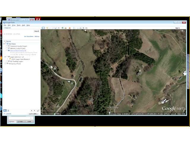
Online mapping tools for the natural resource professional Part 3 Google Earth GE Part 1 Basics M
This mapping tool is a must for all natural resource professionals. It is one of the best ways to develop and share map data with landowners as it allows visualization at the landscape level. You can create, save, and share project datasets freely, view historic aerial images, add GPS, photos and even your own aerial images. This section covers basic information about GE navigation, exploratory tools, searches, layers, and data creation in My Places. Data creation will consist of development of project folders and creation of points (placemarks), lines (pathways), and polygons. Importing GPS data will be introduced. Editing spatial data and descriptive information, saving and sharing data files will be covered.
Online Mapping Tools for the Natural Resource Professional Webinar Series
This is the third in a 4-part series intended for natural resource professionals to become familiar with important sources of online mapping tools and data without the need for a complex GIS program. These tools will provide the basic mapping necessary for land management decisions and plan development and can assist in your work with landowners. While no experience in digital mapping is required for this class, even experienced mappers will learn new ways to create and share basic land management maps with stakeholders. These tools are simple enough that you may teach others their basic use, empowering them with the ability to develop and share their own work.
Part 1: My Land Plan (December 4, 2013, 12 PM Eastern)
Part 2: Important spatial data sources (December 18, 2013, 12 PM Eastern)
Part 3: Google Earth (GE) Part 1 (Basics) (January 15, 2014, 12 PM Eastern)
Part 4: Google Earth Part 2 (Intermediate) (January 22, 2014, 12 PM Eastern)
Тэги:
#Google_Earth #Online_mapping #forestry #mapping_softwareКомментарии:
Online mapping tools for the natural resource professional Part 3 Google Earth GE Part 1 Basics M
Forestry and Natural Resources Webinars
THEATER JKT48 | JKT48 EXE
IAMBOB
50 INCREDIBLY SATISFYING LEAGUE OF LEGENDS CLIPS!
Protatomonster
This PC Gamer is Still in the Closet…
Zach's Tech Turf
Closet Gaming Setup!!!
Klerky
Meeting My Best Friend After 13 Years!
Simran Connects
Kate's New Hair!
LOL Clips


![Points Of Authority [Official HD Music Video] - Linkin Park Points Of Authority [Official HD Music Video] - Linkin Park](https://invideo.cc/img/upload/NGxDazhwQVBTWmo.jpg)


