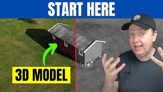
How to Create a 3D Models from Drone Images with DJI Mini 3 Pro
Комментарии:

Great idea. I use WebODM to process the data :D.
Ответить
Good video, but why on earth are you recommending software (Dronedeploy) that costs $329 per month even for individuals? Or am I missing something?
Ответить
You mentioned a free map stitching solution that you'd cover in a later video, but I just scrolled through your videos and didn't see it. Did I miss it or have you not done it yet?
Ответить
Have you tried the NeRF or 3D Gaussin Splatting techniques to create 3d models? I've been using my DJI Mini with Luma AI (as well as 3D Presso and Poly.cam) for some exciting results. Just wondered if you are aware this and what you think?
Ответить
Is this possible to be with the Mavic Mini
Ответить
I am very interested in this. Do you plan on using the mini 4 for modeling?
Ответить
What is the 100% free alternative from Drone Deploy?
Ответить
This method does not seem to work anymore for free. I´m unable to upload anything in free mode.
Ответить
HA HA...hit the dislike button twice! 😄
Ответить
Hi, where can I find the free 3d image software that you talked about? I cannot find it in any of your videos.
Ответить
This is a great video, thanks for sharing. I'm wondering, have you looked at the NeRF models that can be created with the Luma AI and 3D Presso apps? As a fan, I would love to hear your thoughts.
Ответить
I looked through your channel and I can't find the alternative modeling you talked about.
Ответить
I'm curious why you can't just hyperlapse for the photographs instead of manually using the button?
Ответить
Very nice , well explained.
Do you have an option to export the file from the website?
Or it’s only for view?

hi ,
how many days the mail arrives on average

What is the file type, when you create the 3D model when you download it from DroneDeploy and can you import it in Blender or Revit.
Ответить
can we download the result fro that website ?
Ответить
Thank you for this great video. Much appreciated. What is the name of that other free 3D creation software you spoke about? Thank you!
Ответить
Why not use the interval time?
Ответить
Thanks for sharing
I can't wait to try it with the Dji Mini.

Hi,
Thank you for the amazing video, whats the second free software that you compiled the pictures?

I always assumed this wouldn't work well, because there's a significant processing delay when you take a raw image, which I assumed meant you couldn't take images in quick succession. Not to mention the major lag that occurs when while it's processing. My screen is frozen for the duration which is pretty dangerous.
Ответить
thank you very much for this information sir!
Ответить
104 images and a half hour of processing
Ответить
I am pretty sure if you have markers(you have to know the coordinates for those points so they have to be measured) on the edges of the map and one in the middle of the area you would get a better more accurate location of the house but it requires more tools.
Ответить
Also, DroneDeploy should REALLY sell their data/models to Google - and of course, if they do, give you a share of whatever they make from that sale. I think that would speed up the improvement of Google Earths extremely sub-par 3D models.
Ответить
Since the native Hyperlapse mode supports raw, and saves everything as raw images, I think that would be a good option to use as it supports waypoints. Would ensure consistent pictures, too.
Ответить
You mentioned plant health. Does the mini 3 pro capture spectral data? I cannot find this info anywhere.
Ответить
Is there any way to use the Mini 3 pro RC for Nadir mapping via a SDK? Everything I am finding says it’s impossible unless you do it manually.
Ответить
For playing around a play with polycam . super easy
Ответить
Awesome video! thankyou. Can i ask...what's the free software you hinted at please? cheers
Ответить
Very good video sir, you have a a good energy when speaking that makes it enjoyable to watch. Thanks !
Ответить
Very interesting tutorial, thanks to share these pieces of information with us!
Ответить
Wow! I took your advice, I used the free trial and made photos from my dji mini 2 manually, im blown away. I scanned about 20 acres of mountain property in amazing detail. I’m going to make a video about it on my channel, i literally cannot say enough how good it came out. Thank you for showing me how to do it! Ps I’m also going to print 3d models of the property too.
Ответить
Did you ever release a video about some good free software that you talked about ? Been keeping an eye out Maybe I missed it...
Ответить
Could i still use this app with an RC controller?
Ответить
im going to try to make a model of my house, just dont want to get shot down by neighbours :)
Ответить
Thank you, this was a simple and fast intro about shooting 3D models with a drone! I'm looking for a way to capture 3D of a pretty large abandoned factory that is about to be demolished.
Ответить
Hello, nice video.
I'm in the solar business and would like to measure the roofs with a drones before an installation. As lidar is way too expensive i'm wondering if you can do acurate measurments on the 3d model created with photogrammetry. Thank you in advance

it is a fantastic tool... not many drone flyers know it. WebODM has gotten very good, make sure you enable rolling-shutter correction..
Ответить
Parabéns, um excelente vídeo para quem trabalha com energia solar.
Ответить
Can the DJI Mavick air 2 do this ???🤔
I'd be very interested 😬😂

I would like to measure the volume of trees and shrubs from the ground up to say 500 cm above ground. From what I understand Drone Deploy can do this, but Is there a reasonably priced software that would be able to it?
I do understand it may be easier to measure manually on the ground and calculate the volume in a spreadsheet, which I have done before, but having the visual model for future reference will also be of value.

Does anyone know the name of the free software he was talking about?
Ответить
What is the name of the free alternative to DroneDeploy?
Ответить
awesome what a great video... great to see a drone video that is thinking outside the square
Ответить
Great i want to do that with my Mini 3 for a 3D model of my House for Fs2020 but is it only makeable with such a expansive program isnt Blender enough?
Ответить