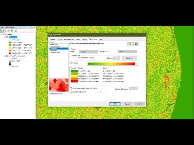
Create Slope map from Digital Elevation Model in ArcGIS - ArcGIS for Beginners
Комментарии:

Hello, I'm creating a map in a similar way- I made it display ranges of data as different colors and shades. So' let's say 25-29% coverage is green but 30-35% is more blue-ish while 50 is blue and it goes up to 90% and above which is red.
I have a few points added to this map and I need to write down the exact percentage, not just eyeball the colors.
How can I have ArcGis give me the value of the coverage in a specific point on the map?

i did it on aster dem it shows only one class ranging from 89.64 to 89.99
Ответить
Have a lab exam in the morning so I'm watching it 🥺 and this is so easy 👍🥺
Ответить
Thank you for this video. It is very helpful. I appreciate you.
Ответить
Please can you help. My classification is coming in only 2 classes after performing slope. What can I do?
Ответить
Great video! could you please tell how to download dem data from Bhuvan ??
Ответить
nice
Ответить


