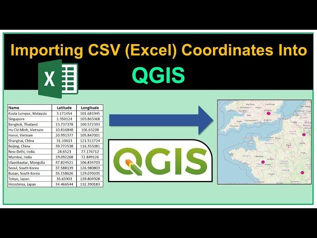
Importing CSV (Excel) Coordinates into QGIS
Комментарии:

Thank you so much! I finally got it right! Thank you thank you!! 🙏🏽🙏🏽🙏🏽
Ответить
Thank you ... Neatly explined
Ответить
what about a polygons
Ответить
How to see latitude longitude and as well as northing easting coordinates in qgis attribute table., Please tell me this sir
Ответить
Hi thanks for the nice video but unfortunately when I do it the exact same way my qGIS does not let me Add my CSV file. The Add button is grey and if I wanna change the geometry definition for the x and y fields I can not change them to longitude and latitude, do you know where I am going wrong? Any help would be very much appreciated
Ответить
Not happening
Ответить
This is exactly, what I have been looking for. Thank you very much for creating such a nice tutorial video. Appreciate that. 🙂
Ответить
thankyou verymuchhhhhh
Ответить
Thanks, It is very useful. Clearly explained. Appreciate the good work.
Ответить
Thanks a lot. I'm still struggling, my csv file does not separate the longitude and latitude. what can be the problem?
Ответить
Hello, why at Geometry CRS at my project its "Invalid Projection" ? Can someone help me ;)
Ответить
Hey brother, where do you extract the csv file from?
Ответить
Is there a way to change or update the coordinate points after importing it to qgis? Or would I have to edit it on excel and then import again
Ответить
Sir i don't have quick map service how can i get that?
Ответить
Nice tutorial, thank you so much
Ответить
I followed every step but it wont work do you need special settings for excel of something?
Ответить
How to download landslide point in qgis
Ответить
Please take the online classes,...
Ответить
Good work
Ответить
Thank you for the shearing! I started my own project and had no idea how to add the data.
Ответить
When I import ths CSV file, the table is not separated. The columns of X, Y coordinates go to one column. Why is that happening? I have made the original excel table like yours
Ответить
Thank You, Good work 👍
Ответить
So much great title keep it up bro
Ответить
Me salvaste de la frustración 😁, pues cargaba el archivo como capa vectorial y simplemente no podía hacer que QGIS reconociera el formato de cada columna del csv. I LOVE YOU!!!
Ответить
Great work bro!
Ответить
LIFE SAVER! Thank you very much for this video.
Ответить
Hi, I imported this csv data to qgis and it displays the dots, but when I added the OSM, it is displaying them as dot outside of the map. Should I change CRS for the imported data, OSM or project or any other changes? Thanks
Ответить
I cannot express how much I despise this program. Sadly, I am forced to use it for work. Thanks for the tutorial, helped a lot
Ответить
thank you so much.
Ответить
Thank you. For some reason it is not working. I have followed the instructions bit what opens qgis a table without information. My excel look just like your. What could be the problem?
Ответить
sir when u clicked on web u got so many options but for me it is showing only meta search
Ответить
Thanks 😊
Ответить
Thank God for people like you, helping us poor struggling folks everyday! Very simple, step-by-step explanation. Thank you very much!
Ответить
Thank you.
Ответить
Thanks alot. Used MGE & Arcview many years ago. I don't find QGIS easy to use (but I appreciate how good it will be) but you explain it very, very well.
Ответить
Legend. Great video, thank you.
Ответить
THANK YOU!
Ответить
Thank you so much! This was exactly what I was looking for. Clearly explained with no nonsense and no expert language.
Ответить
Love every videos of yours. Keep up the nice work sir
Ответить
Thank you
Ответить
Thank you
Ответить
Thank you. You really help me but i have misunderstood how gives name to points .
Ответить
Thank you for this video! I am trying to do a GIS assignment at university and had no idea how to do it. You are a life saver!
Ответить
Thanks a lot! It was very very helpful!
Ответить
Thank you for your nice tutorial so can you please let me know how to change the file to GPX so I can use it with Garmin GPS
Ответить
Thanks ihope to be professional Qgis I need more lectures
Ответить
sir can you suggest some portals where i can find Indian city lat longs . Or good open-source portal in india
Ответить
good
Ответить
Thank you
Ответить
well explained
Ответить


