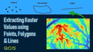
Extracting Raster Values using Points, Polygons & Lines | QGIS
Комментарии:

Thanks alot!
😅 I had like 15000 points,
entering the data manually was a load

In QGIS 3.28, Zonal statistics is not avalaible anymore 🥲
Ответить
thank you very much for the video so I have a question in case of the profile of line, if we want the create a distance between point is 200 m, how we can create the profile. Thank you
Ответить
very good tutorial. thank you
Ответить
Excellent video
Ответить
Great sir, thanks a lot.
Ответить
Hi Geodelta labs, When I installed SAGA, it did not work. Is there any way we can do it without using SAGA?
Ответить
Sample raster values (point)
Zonal statistics (polygon)
Profiles from lines (line)

Thank you for the great tutorial. Really helpful.
Is there a way to do batch zonal statisics from polygons?
I have a set of around 100 multispectral images, each with 5 bands (layers).
I want to find zonal statisics for each band in each image.

Thank you 😊
Ответить
THANKS!
Ответить
Good info. What would be the next step to identify the actual min and max points in the raster for each polygon?
Ответить
Very helpful
Ответить
I have already a points and I wants to extract raster data of that point then what I do...
Ответить
Could you please make a video on how to clip a netCDF file using shape file? This would be of great help.
Ответить
Sir, please make a video on ArcGisPro
Ответить
Kindly make some more videos on Arc GIS
Ответить
How to extract values from those three polygons, like what points and polylines do? thanks a lot...
Ответить
It's really nice! Thanks a lot for that.
Ответить
Thank You
Ответить
Thanks you 😊😊💖
Ответить


