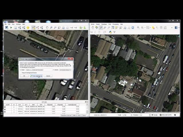
Download and georeference Google Earth images in QGIS 2.8 with OpenLayers Plugin
Комментарии:

I don't agree with you, Weblayer need an internet connection and Georeferenced images can be used offline , also you can use it in other software like ArcGIS , ERDAS,...
Ответить
You don't need so many refrence points. This task can be done with three points only as it is an affine transformation. But I agree with @panzika1: it does not make sense! openlayers images are already georeferenced. if you make a simple screenshot of images in google earth you get shitty wuality images as the resolution is defined by your screen. If you want to get high res images you should use "google satellite maps downloader" or build your own python script in QGIS.
Ответить
I need of sound, please....
Ответить
Thank you for your help! I give you a like. Maybe you will talk next time :D Would be better.
Ответить
NO ENTEDI NADA
Ответить
Thank You for this nice tutorial!
However I seem to have difficulties in uploading resulting georeferenced tiff file directly into postgis or through geoexplorer. The resulting layer is at best misplaced by couple hundred meters.
Could you give some tips how to overcome it? (how to upload resulting tiff file to postgis)

Thaaaaanks!
Ответить
Is there a way to then make a georeferenced PDF map from that image?
Ответить
Great!
Ответить
I am sure that my GEarthView plugin for QGIS will be of your sure interest.
:)

Hi Monde, thanks for detailed tutorial. the issue I m facing while fetching the Google earth view data is API error message is "Printing and rotating javascript API based layers is currently not supported", could you tell what might be wrong in installation.
Ответить
No voice.
Ответить
what is the solution of this problem"Printing and rotating javascript API based layers is currently not supported"
Ответить
hello sir . i want citycad 2.8 programs please help me
Ответить
simlicity is appreciated in your video..thanks
Ответить
salut je voudrais avoir des tutoriels sur le logiciel Insat+
Ответить
I can't install open layer plug-in in qgis 2.18.25, did you no Wai?
Ответить


![ASMR ROLEPLAY BOYFRIEND INDONESIA | Merawa pacar sakit | [Caring] ASMR ROLEPLAY BOYFRIEND INDONESIA | Merawa pacar sakit | [Caring]](https://invideo.cc/img/upload/Y3dJLWkybkljeGM.jpg)


![[free] pluggnb type beat "down on me" [free] pluggnb type beat "down on me"](https://invideo.cc/img/upload/d3hHc0NMbkZybE4.jpg)
